
Jōzankei Tengu‑dake
Jōzankei Tengu‑dake (定山渓天狗岳) (1145m.a.s.l., 9.5km distance) sits on the southern edge of the Sapporo Volcanic Group, a landscape formed by repeated eruptions and uplift over hundreds of thousands of years. The rugged cliffs and exposed rocky spine near the summit are remnants of ancient volcanic activity that shaped the Toyohira River valley. The steep, narrow ridges that hikers climb today are classic features of Hokkaido’s older volcanic terrain.The mountain overlooks Jōzankei Onsen, founded in 1866 by the monk Miizumi Jōzan, who discovered hot springs in the valley and established a small healing retreat. As the onsen town grew, so did interest in the surrounding mountains. By the early 20th century, Tengu‑dake had become a popular training peak for local mountaineers and students from Sapporo.
Today, it remains one of the closest “real mountain” experiences to the city — steep, scenic, and accessible without long travel. The route to Jōzankei Tengu‑dake begins from the small gravel parking area with a trail hut not far from the base of the mountain. Follow the forestry trail that winds along the river to the right for around 2 kms before we reach a well‑cut trail which enters mixed forest and immediately starts meandering along a series of secondary streams that lead up to a narrow set of small bluffs. Stay on the trail from this point on as there are some serious drop offs that are well hidden by the dense sasa.
The first section is a steady ascent on firm soil with occasional roots, gaining elevation quickly as the ridge narrows. After roughly 30–40 minutes, the gradient steepens and the trail transitions into a series of short switchbacks, before entering a deep, steep re-entrant/gully. The climb becomes more pronounced here as it is a steep, steady ascent up the rocky terrain following a gully and re-entrant.
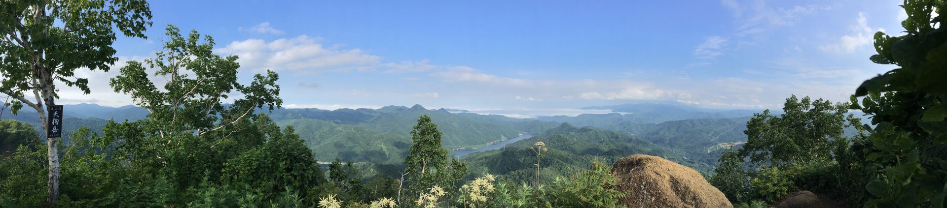
Around the 900m mark, the forest begins to thin, and the terrain shifts to rough volcanic rock and low alpine shrubs. The trail remains obvious but becomes looser underfoot, with small scree patches and exposed sections where caution is needed, especially in wet conditions. The final approach follows a small chute to the right of a tight saddle trending east toward the summit block, where the path steepens for the last 10 minutes before topping out on the compact summit plateau. From the summit, views extend toward Mt. Soranuma, Mt. Muine, and the surrounding ridgelines. The descent follows the same route, with particular care required on the upper rocky section and the steep forested ridge, both of which can be slippery when damp or when the first snow falls in early November.
Difficulty-7/10.