
狩場山, Kariba‑yama
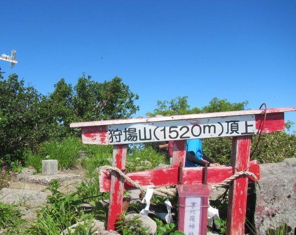
Mt. Kariba‑yama is the highest mountain in the southern part of Hokkaido. Its name comes from the Ainu karinba‑ush‑nupuri, meaning “mountain where there are cherry (sakura) trees,” which makes you wonder whether more cherry trees once grew here. Heavy winter snow feeds the Chihase‑gawa (千走川) and Sukki‑gawa (須築川), two of the clearest rivers in Hokkaido, and the mountain is surrounded by other peaks above 1000 meters—Mt. Higashi‑kariba‑yama (東狩場山), Mt. Fumonnai‑dake (フモンナイ岳), and Mt. Okotsunai‑dake (オコツナイ岳)—so the whole area feels like a single broad massif covered in Japanese beech.
There are five trails up the mountain, but the Baba‑gawa Trail (馬場川コース) has been closed, and the Chihase Old Trail (千走旧道) is also falling into disrepair. In this guide you’ll climb the shortest and most commonly used route, the Chihase New Trail (千走新道). From Shimamaki (島牧) you follow a forest road along the Chihase‑gawa, passing the Garo Marsh (賀老高原) campsite, until the road ends at the trailhead.
On Kariba‑yama the Japanese beech treeline is low—around 750 meters—so shortly after you begin climbing the beech forest gives way to Erman’s birch. The trail angles west and then north as it begins to rise more steeply along the ridge. Where the eastern slope rises diagonally above you, the forest opens into a shallow basin where snow may linger as late as August; as it melts, meadow buttercup, short‑stipule violet, Kamchatkan St. John’s wort, and other flowers appear.
A little higher, in a small snowy valley, you reach the junction with the Makomanai Trail (真駒内コース). The grassy fields here are filled with unbroken mats of Aleutian mountainheath. Beyond the junction the ridge narrows and leads toward Minami‑kariba (南狩場), a small secondary peak. Views open back toward the Chihase valley and across the rolling beech ridges typical of southern Hokkaido.
As the slope eases, the ridgetop becomes broad and gentle. You pass a small pond where deer cabbage grows in early summer. Just before the summit, the faint line of the Chihase Old Trail merges from the east. The summit of Mt. Kariba‑yama is a wide, grassy dome. To the southwest the Sukki‑gawa valley drops away in a dramatic sweep—a deep, forested gully known for its rugged river travel. To the west, the long ridge stretches toward Motsuta‑misaki Cape (茂津多岬) and the Sea of Japan.
You return the same way. The Chihase Old Trail begins near Garo Marsh and winds endlessly through beautiful beech forest, but as more hikers choose the shorter New Trail, the Old Trail is becoming increasingly overgrown with sasa. If you choose to climb it, bring a map and compass. The Makomanai Trail climbs from the east through especially fine beech forest, and the long western ridge from Cape Motta Lighthouse/Motsuta‑misaki is a demanding route recommended only for experienced hikers. This route is a 20-kilometre route up and back with a 1400 metre altitude gain. Allow a full 10 hour day of hiking at the least.
Season
Beech leaves emerge at the end of June, though snow still lingers along the ridges. Through July and August the snow melts and flowers bloom one by one. Mid‑October brings excellent beech foliage across the entire massif.