
Muine‑dake (無意根山) .
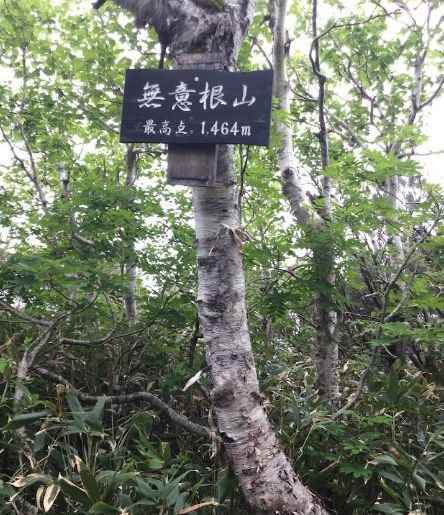
The climb to Muine‑dake (1460masl, 13.2kms) from Route 230 begins at the small trailhead set back from the highway next to the University Alpine Clubhouse. This known as the Usubetsu route. We follow a forestry trail for approx. 4.5 kms up the valley passing alpine tarns and an occasionally smelly hot spring set off the trail, before reaching the small trailhead hut. Again, like manly of the trails in Hokkaido, we may encounter the local fauna such as shika deer and very rarely Higuma (Hokkaido Brown Bear). But following the correct protocols will ensure we have a safe experience if we do.
A narrow path enters dense mixed forest through marshy terrain with the occasional alpine tarn and a few creek crossings with the aid of ladders. Once we negotiate this terrain we reach the site of the old university mountain hutte (sansou) which unfortunately burnt down in November of 2024. Once we pass this area, we ascend a series of wooden ladders and steps to reach the lower section of the Muine-dake massif and immediately start a steady ascent along a broad ridge trending generally northwest. The lower section is well‑defined, with firm soil and intermittent root systems, gaining elevation gradually as the ridge rises above the valley. After 30–40 minutes, the gradient increases and the trail transitions into longer, more sustained climbs, with occasional openings in the trees offering early views toward Sapporo Lake and the surrounding foothills.
Around the 900–1,000 m mark, the forest begins to thin and the ridge broadens, leading to a series of undulating rises that form the mid‑mountain approach. This section can feel long, with several false summits and exposed stretches where wind and lingering snow may persist into early summer. The terrain shifts to volcanic gravel and low alpine shrubs as the route approaches the final shoulder, where the trail bends west and begins the main summit push. The last ascent is a steeper, more direct climb up a rocky slope with loose footing in places, requiring careful steps but no technical scrambling.
The summit of Muine‑dake is broad and open, offering panoramic views toward the majestic Yoteizan (Ezo Fuji), Kimobetsu-dake, Yoichi‑dake, the Jōzankei valley, and the Toyohira River watershed. The descent follows the same route, with particular attention needed on the upper loose sections and the long mid‑ridge undulations, which can be tiring on the return.
Difficulty-6.5/10